3D Laser Scanning Services
High-Resolution Data for Smarter, Safer, and More Efficient Field Operations
At Trident Group, we leverage technology with purpose, utilizing advanced tools such as 3D laser scanning to drive efficiency, support value engineering, and help our clients manage long-term operational costs through informed, faster decision-making.
Scanning Services
Our scanning services are delivered through our strategic collaboration with AIMS and are integrated directly into Trident’s broader QA/QC, engineering, and safety programs. Whether used for dimensional verification, digital twin development, or inspection-grade visualization, our scanning solutions are tailored to support complex field operations, helping clients move confidently from planning through execution.
Together, Trident and AIMS deliver a combined service
offering that enhances decision-making, safety, and ROI.
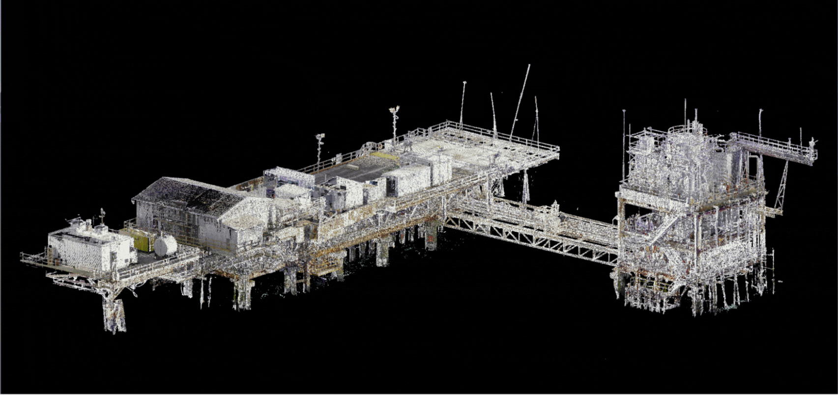
3D High-Definition Laser Scanning (HDS)
- Captures ultra-precise point cloud data of industrial environments, piping systems, structural steel, vessels, and offshore platforms
- Enables true-to-field as-built documentation, dimensional verification, and basis for intelligent model development
- Ideal for brownfield facilities, expansions, or reverse engineering scenarios
3D Intelligent Modeling & Digital Twin Development
- Converts scan data into detailed, object-based 3D models with embedded attributes such as component type, size, and material
- Provides clients with intelligent digital twins for long-term facility management, asset tracking, and operational planning
- Supports design validation, clash detection, and integration into BIM workflows
Drone Surveying & Aerial Mapping
- Employs UAV-based LiDAR and photogrammetry to safely capture topographic, thermal, and structural data across wide or hard-to-access areas
- Supports large-scale site planning, volume calculations, and inspection of assets such as tanks, flare stacks, and rooftops
- Enhances safety by reducing the need for scaffolding or rope access
2D Engineering Drawings & Dimensional Control
- Produces construction-ready deliverables including orthographic drawings, isometrics, P&IDs, and alignment reports
- Offers millimeter-level dimensional control for fabrication, fit-up, and verification of critical components
- Reduces rework by validating fabrication accuracy before site installation
Ground Penetrating Radar Surveying (GPRS)
- Locates underground utilities, voids, and structural elements beneath concrete or soil without excavation
- Provides accurate mapping for pre-construction planning and risk avoidance
- Often combined with scanning and drone data for full-scope site assessments

Client Benefits
Enhanced Project Accuracy
»
Eliminates guesswork in design and construction through precise, high-resolution spatial data.
Improved Efficiency & Safety
»
Reduces field exposure time and improves planning through remote data capture technologies (e.g., UAV, GPR, laser scanning).
Integrated Digital Deliverables
»
Delivers intelligent models and drawings that integrate seamlessly into CAD, BIM, and facility management systems.
Support for Engineering, Fabrication, and Inspection
»
Provides QA/QC-ready measurements, alignment verification, and inspection-grade documentation for asset owners and fabricators.
Adaptability for Diverse Environments
»
Services are well-suited for offshore platforms, industrial plants, petrochemical facilities, and urban infrastructure.
End-to-End Data Integration
»
Enables clients to visualize, analyze, and manage complex systems from early planning through lifecycle maintenance—all based on verified field data.